Storm Chasing Blog

During the spring seasons of 2015, 2016 and 2017 I have been fortunate enough to be a guest storm chaser on Paul and the Netweather.tv storm chasing team.  The tours operate from the beginning of May until the end of June, covering the expansive Great and Northern Plains of the United States of America. They have an amazing track record of landing themselves on productive supercells, where lightning, large hailstones and tornadoes are a common sight throughout the tour. I will once again be joining Netweather and Weather Holidays to chase the 2017 Spring Storms.


May 2018 saw me chase as a small team, with fellow chasers Adam Simpkins and Oliver Ewers. Despite the lack of tornadoes in 2018, we seemed to hit every picturesque storm we travelled to - including the rarely documented Pine Ridge Supercell in South Dakota. However, we did miss one of the highlights of the season through a few rookie errors.


I have since retired from actively storm chasing in the USA due to family commitments, but will return to the Great Plains again in the future...and when I do - I'll update you on the adventure. I will, from time to time, update the blog with significant weather events from wherever I may be.


Return to the Storm Chasing Page


Total Tornado Count: 28

Filter:

Latest Posts

Time for reflection...

Posted on 15th August, 2018

I've been back in the UK for a couple of months now and had a long time to reflect on my experiences chase as a small team and the stories I have to tell. I was also forced to throw myself into working again as the start of the year was atrocious for booking and resulted in a minor cashflow problem, which has thankfully been rectified now. I also have had my first traditional holiday in a good 4 years this year in that time and as such have finally got myself together enough to start to go through footage and photographs to share. 


I will be splitting my free time (or free time that I have set aside to work on personal projects) between going through photographs and video to create some storm documentaries of the chases this year, as well as focusing on my longstanding ambition of creating a social media resource promoting eyes and eye health. This project, known as Eyes On Eye Care, will take up the majority of my time as I aim to maintain this ambition throughout my professional career as an optometrist. 


Eyes On Eye Care


As it stands, I will also be studying for a further qualifications within optometry, planning a wedding (and family...) and focusing on my career as an optometrist. This unfortunately means that my USA chasing days are over (well, for the medium-term at least...). I will always be buzzing when storm clouds roll in and be watching Olly, Adam and the Weatherholidays.com team each storm season and wishing I was out there with them chasing Nature's finest weather. 


For now, keep posted as I shift some of my content from my memory cards and through my video processor and on to this site and YouTube!

We awoke from the hotel in Enid and had chilled start. Not making much of the breakfast, we packed up and head off towards the nearest McDonalds. There was time to kill today and with the enhanced risk given by the SPC given due to many models showing a mesoscale convective system forming just outside the Oklahoman panhandle and blasting east over north-western Oklahoma over the evening and night, we had decided that we would head to Woodward for a hotel, push out west towards where they would initiate before letting them follow us back to the hotel and to let it pass over us.


The lads also wanted to check out the nearby airbase at Enid (Vance Air Force Base) and watch some of the planes fly over. We were watching them for a good 30 minutes before heading off towards Woodward.


The journey to Woodward was becoming a familiar sight as we have passed through here many times during our chase this year. We located a Days Inn, which had a slight south-west view, which we thought would be a perfect view if the expected storm  behaves the way we had hoped it would. We couldn't check in until 3pm and it was 2:30. We wanted to move and get into position, so we collected our keys and got back on the road, where I took the wheel.
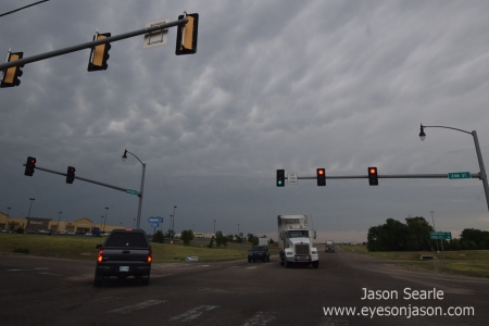
 

Mammatus starting to show over Guymon, Oklahoma

Mammatus clouds beginning to form over Guymon, Oklahoma


Our plan was to target Guymon (in the panhandle) and meet the storm as it followed its forecast path. We stopped off in Guymon for some food, where we spotted an Italian type restaurant and pulled up. It felt very weird eating at about 5:30 pm on a chase day. Usually we are midway through a chase, but we were eating our evening meal before the chase had become. The restaurant we chose was Mazzio's Pizza.


The place looked quiet, so we thought we could go there for a quick bite and get back on the road. Olly and Adam ordered a pizza and I ordered boneless chicken wings. We took a seat in a small booth (where even I struggled to fit in) and waited. And waited. And waited. for an empty restaurant, it took a good 50 minutes to receive our food - which for an empty restaurant and basic food, seemed a bit too long. At one point I was ready to get up and go, but the food arrived just in time. We wolfed as much as we could before Olly picked up the car keys and we head further west to meet the storms, that were already starting to line up nicely.
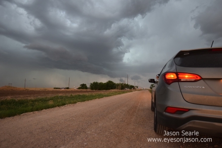
 

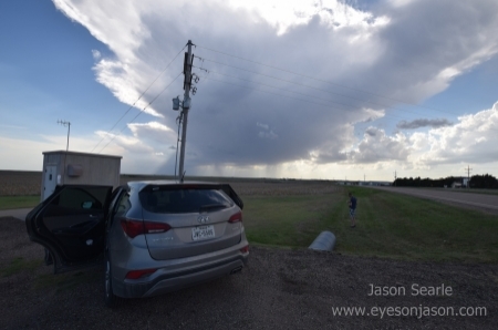
The Hyundai Santa Fe before the storms

The storms beginning to get organised


We pulled over to take a few structure shots and to observe the storm organising. I was a little uneasy as my location marker had disappeared on Radarscope, making it a little more difficult to give our exact location in relation to the storm. I wasn't too worried about the hail, the winds or tornado rok, but from this I was most worried about the lightning. The reason for this was there were frequent lightning strikes in front, beside and behind us. I stuck to my usual tactic and stayed in the car.
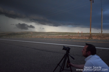
 

Adam Simpkins, Wiltshire Storm Chaser photographing the storm

Adam taking photographs of the storm


The storm was racing towards us at a rate of knots (I think we worked it out to be moving at speeds of up to 35-40 mph) and it soon was upon us. We hopped back in the car and drove a few minutes before pulling over again for more photographs. Again, it was on us in a matter of minutes, making us realise that we would need to keep pushing forward for longer before pulling over to maximise our time imaging it.


There were many lowerings that made brief appearances and the radar showed many areas of persistent rotation. Could this storm produced a tornado for us? Out of the blue, a not-to-distant lightning bolt struck in the field next to us, quickly causing a new fire. The fire started to grow rapidly, causing an impressive amount of smoke. This smoke was soon to be lit by the large fir causing it, with it being inhaled by the monster of a storm system behind it. It was both very cool but very dramatic. We feel the outflow from the storm helped to fan the flames, causing the fire to spread more rapidly, but wondered if the storm's precipitation would extinguish it just as rapidly.


We soon approached Guymon on our return pass. We drove into town and filled up with gas. The sky looked very ominous and I have to admit, very low bases on severe-warned storms in a town/city environment never sits easy with me and I was glad when we were back on the highways again. We pulled up just east of the city limits and again stopped for photographs and video.
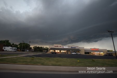
 

Stormy skies above Guymon, Oklahoma

Stormy skies over Guymon, Oklahoma


Lightning here was quite intense and I definitely didn't fancy getting out the car. Adam and Olly did so bravely, before a close CG strike caused even Adam to get in the car. Hats off to Olly, he was incredibly brave to stay outside as long as he did. We soon got back in the car and decided that we should really make tracks to get back to Woodward to make sure we are at the hotel before this passes over us.


Essentially the race was on. Those that follow me on facebook would have seen the video of us travelling east with the crazily impressive structure behind us, with constant lightning from all directions. This was probably the most intense storm in regards to winds and lightning I think I have ever been near. It was a new, but exhilarating experience.
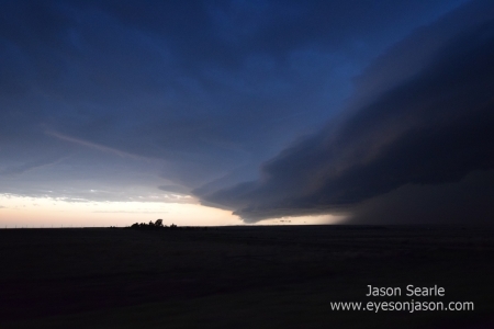
 

Structure now showing as it races eastwards

Structure forming and a susect lowering as the storm races east


On the hour or so journey, with the storm on our heels most of the way, we saw an unusual sight. We could see the moon rising up from the horizon - with an eerie red glow. It must have been due to a mix of the sun setting behind the storm and perhaps some effect of the sunset travelling through the storm itself. It soon rose out of view as the anvil occluded our view.


It wasn't long until we arrived back at the hotel. We rushed to our rooms, but I couldn't get in. After 3 attempts of trying the door, the occupant answered - they had allocated me the wrong room number. A mad rush to the hotel desk soon had me allocated to the correct one, where I dumped most of my belongings and took out my camera and tripod, before joining the guys just outside to start photographing the incoming storm.
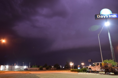
 

Storm base crossing over Woodward, Oklahoma

Stormy skies over Woodward, Oklahoma


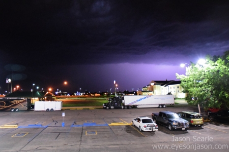
Frequent lightning was easy to capture, as was the structure. We had about 5 minutes (max!) before the storm was upon us and we dived into an alcove of the hotel to watch as the 60 mph winds and rain whipped by our hotel, firing small to medium sized debris into the location where we had been stood only minutes beforehand.  It quickly intensified and the sky was almost just permanently purple-lit with lightning, perfectly illuminating the precipitation all around us. We soon bugged out back to Olly and Adam's room and watched for 20 minutes as the mesocyclone passed over our heads.


The rain was some of the most intense I've seen and the drainpipes were pumping it out as if there was an electrical water pump that had been installed just in front of us. It eventually came to a close and there was a sense of calm as the meso passed to our east. It left us with a wonderful light show, with plenty of anvil crawlers and a constant, but relaxing, roll of thunder.


With that, I walked out the hotel and just stood there and watched the storm move away. In my heart, I knew this was likely to be the last storm I'll witness this trip. I also know that due to family commitments and family plans over the next few years that this could even be my last US chase season storm for a long time (if at all). With no camera, no phone and no video camera, I stood there, watching and breathing in the storm. Every rain drop that hit me, every  lightning bolt that lit up the sky and the sound of every rumble she gave, I will hold with me.   I can only liken the feel to a break-up with a loved one - I sound really pathetic saying it, but thanked the storm and reflected on how I'll miss this lifestyle, the grounded feeling I get for seeing such forces of nature in play, making me realise that all my problems and worries are negligible in comparison to the grand scale of the world and universe that we live in. I may have shed a few tears.


After about 20 minutes of just standing there, I composed myself and grabbed a beer, before returning to the lads that were watching The Weather Channel, of which was showing the storm, now tornado warned, heading over Waynoka and beyond. It was our first potential night time tornado to follow on TV and we all got very into it. It never did go on to produce a tornado, but it was well worth watching the progress of the storm that we had located and tracked earlier that evening.


Half hour of watching the updates, I returned to the room, gave Hannah a call and then went to bed. It's likely to be  a down day tomorrow, and we will start our journey back towards Dallas, ready to make the 3-4 hour drive to Austin on Saturday. It's not long to go now until I'm back.


Storm season 2018, you've been a pleasure to chase. Tough season, but if you were willing to put the hours and the miles in, it provided some fantastic storms. I can safely say that this year, I have moved from storm tourist to storm chaser - a dream that only 5 years ago, never thought I would ever be able to achieve...


Let's see what the future brings...


Jason
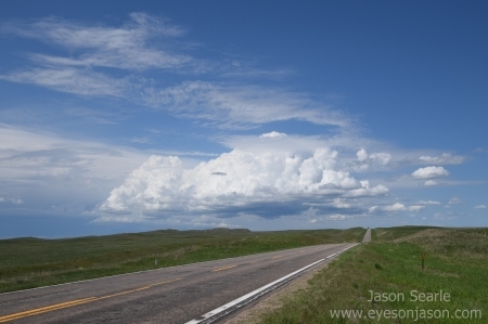
Englewood to Enid Supercell - May 29th

Posted on 31st May, 2018

(Written on May 29th - once again, poor wi-fi and lack of time to upload results in posting today!)


Morning started with a refreshing shower, before heading down for breakfast. Super 8s are generally ok for food and this one didn't disappoint. A waffle and syrup, an orange juice and a coffee all went down nicely, as I caught up with Paul, Jock, Adam and Olly to discuss models and expectations. We still maintained that we didn't want to have the target revealed to us and that we were going to work it out for ourselves.


Leaving the hotel at around 10 am, we head south to Garden City (Kansas) to locate a Verizon shop. We were running low on hotspot data, so had to top-up. Unfortunately Olly couldn't top up using his credit card on the app as it required the credit card he was using to have a US ZIP code. This meant we had to go to a store to manually top up. I took the wheel for the 90 minute drive south and by the time we arrived, I was shattered. Our target was Medicine Lodge (Kansas)


Adam took over from here whilst Olly sorted out the data. A quick refuel then saw us head southeast towards Dodge City, where we stopped at a Bella Italia for lunch. It was pretty dark inside and didn't help with the feel of tiredness that we all shared. The lasagna was nice and a Dr Pepper helped to perk me up with a sugar boost. The stop also gave us time to check models and the SPC, which had indicated the outflow boundary we were going for had dropped further south.


Heading south through Dodge City (after being held up by a very long freight train), I saw many of the sights that greeted us as we drove through Dodge on the day of the tornado outbreak just 2 years prior. Although optimistic, I didn't think there will be another day like that, well, not for a long time anyway! We continued south towards Minneola, where the Dodge City outbreak began and passed again through many of the locations we had stopped in. Sadly, the view today was relatively boring in comparison. A quick refuel and we continued on our way south, where a storm had just started on the boundary, currently at Englewood. Olly picked up the driving from here.


Explosive convection during the initiation of the supercell

Initiation of the supercell we would be tracking today


As we continued south (and then accidentally taking a road east...where we had to turn back on ourselves) before blasting by Paul and the Netweather guests (tooting as we went by), where we could see the strong updraft building in front of us. It was slowly moving east, so we decided that we would turn east on the county roads before we hit Rosston, travelling close to the base as possible. We had to stay close as it soon started to precipitate and given our position, we didn't want our view of the area of interest to be occluded by the rain and hail.


We zig-zagged south east on these roads. The rotation was certainly picking up and a hook was beginning to form. here were several blasts of rear flank downdraft winds. This was promising for tornadic development and we had the rime view of a persistent wall cloud and areas of rotation. There were times we thought it was going to drop. As we pulled away from one of our stops, the car made a very unusual noise - almost as if we had a flat. Thankfully we didn't and it was something caught on the mud flaps, but it was a bit worrying as we thought our chase would have been over.


Lowering from the supercell

The lowering beginning to form


It was at this point that we had spotted on radar (and social media) that a storm had gone up at Dodge City, which went on to produce a spectacular stovepipe tornado. It looked near identical to the one that raced through the cornfields in front of us two years ago. It is always disappointing missing out on a tornado (as we really found out yesterday), but took some solace in the fact that about 99% of the other chasers on the road today also missed out on it.


The whole thing ended up rotating in front of us and radar showed it was edging closer to us still. We hit the road and head south to join highway 64 and move east to stay out in front of it. Chaser convergence was extreme today. Loads of cars, TV network vans and chaser vehicles were out, as were the portable research radars, which made the roads extremely busy and dangerous. Thankfully it wasn't too bad to navigate and Olly did a fantastic job given the conditions.


We continued east along highway 64 and across the Cimarron river (it seemed strange as we keep crossing on this road this trip - 4 times out of all the roads and points in the US...at least we are consistent about something). Watching, the hook soon became occluded by 3.50" hail, with a TVS (tornadic vortex signature) deep within. Ideally we still wanted a view inside so we had to keep to its south east to peer inside. Unfortunately the precipitation was too heavy and limited road options meant we were never going to be able to see inside.


Persistent lowering from the supercell

Persistent lowering and rotation from the supercell


We stopped several times to take photos and to admire, before taking a right to drop down south through Waynoka. At this point, new areas of rotation were forming and a severe warning polygon appeared in our area. Additionally, some of the precipitation was heading our way, with the chance of some hail. We raced south from Waynoka, with large rain droplets hitting our car. Once a few miles south, we pulled up on a westward facing road for more photographs and video.


The core rolls closer

The core rolls ever closer


The storm slowly (I mean really slowly) rolled towards us, with many different areas of rotation that could have dropped a tornado. There was a report of one tornado at this point, although some other chasers that we had spoken to had said that it was more of a funnel cloud than anything. Still, it was reported... The storm continued to roll closer towards us and we continued again south (trying hard not to be caught up in the chaser convergence).


The storm became tornado warned

The storm became tornado warned at this point


Once reaching highway 412, we took an east road. At this point we were considering hotel options. Enid looked the best place to go and we soon booked up America's Best Value Inn. The breakfast in these are not the best, but the rooms are comfortable and they are usually a pleasant stay.


Continuing towards Enid, with the storm close to the northwest of our position, I looked out towards the north and started to see a new wall cloud start to form. We managed to pull over and observe the wall cloud try desperately to try and form a tornado, but despite trying very hard...it decided that it wasn't going to drop. It was disappointing, but still a thrilling sight to see as the storm continued to head east with its 3.50" hail core.


Funnel cloud on the storm

Funnel cloud retracting back into the storm

(video of this is better...will share when I can!)


We possibly stopped for a little too long as we had to follow the curve of the road towards the north, just by Cleo Springs. We started to approach the junction, giving us an east option, when the wind picked up and in the distance we saw huge amounts of dust whip up by a gas station, swirling and twisting at the same time. It subsided and then picked up again with high intensity. Was this the tornado we had been hoping for? Looking back at our videos and talking amongst other chasers, it appears that there was no rotation above  for it to be a tornado and what we had witnessed approximately 100 metres in front of us was likely to have been the less hazardous "gustnado". Disappointing, but also thankful that we stopped where we did and nothing formed from the skies above. We were still in a safe position, given the track of the storm (so no worrying from those that do at home!)


The rest of the drive was uneventful, with a short drive towards Enid, where we stopped for dinner at a Chili's restaurant, our first of the year. Fajitas on the menu and opting to be the designated driver to the hotel, we ate, caught up with Paul and his team (who had also chosen to eat here) before returning to our hotel. Despite no tornado, we counted this as a successful chase.


The night was still not over, as a new storm followed the one we had chased, which had a nice amount of rotation on it and a bit of a hook. It was due to pass right over our hotel, so we got prepped with our cameras and phones and enjoyed watching as the heavy wind, rain, hail and frequent lightning gave us a fantastic way to end the chase. Tomorrow's chase had also just gone from a marginal to an enhanced, so we may even get one last spin of the chasing wheel before we need to pack up and head south back down to Austin.


I have so many photos that I cannot wait to share, but I do want to go through them all and make sure I get the best out of them before I share them here I have included a few shots to give you an idea on what I have seen. If you can't wait, I have a few videos and photos on my facebook/instagram pages (@eyesonjason).


Right, time for bed I think. Until my next post, stay safe!


Jason

Head or Tails? May 28th

Posted on 30th May, 2018

After my alarm failed to wake me this morning, I panicked as I had overslept slightly. Not to worry however, as both Olly and Adam had done the same. It may have been the comfy bed and safer surroundings, or the fact there was a relaxing rumble of thunder all over the night. The risk for today was in our area and had been upgraded to an enhanced.


Discussing options over the impressive breakfast (it was a huge area with loads of space for the many guests). We thought that we would initially head south to Kansas (a town called Sharon Springs), but upon leaving, the SPC had updated their outlook to the option in NE Colorado and issued a 10% risk of tornadoes. This seemed like too good an opportunity for us to see a spinny thing, so at the next opportunity we turned west and set off towards NE Colorado, target towns between Wray, Yuma and Brush.


We stopped at Wray to re-evaluate as the data service in this neck of the woods is beyond dire. In fact, AT&T don't seem to be present here at all. We popped in to a Subway here and the staff were quite excited to see us as storm chasers. The guy who took payment even called us weather heroes (although I do think that is pushing it a little...).


Reevaluating, with a recent mesocale discussion issued, we needed to drop south, so pointed the journey to Idalia, which eventually saw us drop back down through a boundary to Burlington (again).


cloudy on all levels

Low level clouds made it hard to locate updrafts


Refuelling here, we sat and waited for initiation. Looking above our heads, the sheer of the clouds was insane. Lower level clouds were moving one way, mid-level clouds moving another and the upper level clouds moving in yet another direction.  That was on top of the surface winds moving in (yes you guessed it) another direction. My only concern was the wind sheer was too great that it would sheer off any updrafts that formed.


Unfortunately there was a lot of lower level clouds that made it difficult to see the updrafts forming. I had my eye on one to our west, just north of Flagler. It had gone up quite quickly, was sat on the outflow boundary and throwing out lightning according to Radarscope. Another had formed to our east, also growing quickly. I had opted for a preference to the Flagler updraft, namely as it reminded me of some of the other big chases I had been on with Netweather, but a 2-1 concensus to go for the cell to our east, which was growing quickly but had moved north of the boundary.


Heading north and then eastwards, we followed the cell as it started to track northeast We were able to stop a few times to observe the impressive updraft that was forming and its corkscrewing nature. Frequent cloud-to-ground lightning and the mild rotating nature gave us a bit of confidence that we may be on the right storm. Our only concern was that the bases seemed a bit too high, even though we were in a hilly area.


Radarscope had indicated a hail marker on this storm of about 1.5" hail, and we wanted to get ahead of this storm before we got cored and lost view of the bases that had formed.  As we were driving along, I did spot a wall cloud and a funnel descending from it, although the others in the car did not spot this. It would appear that I wasn't the only one to do so. As we brushed by the edge of the core, all the phones in the car buzzed and flashed up that we were in a tornado warned storm polygon. Excitement grew, but we had now passed by St Francis in Nebraska, where the data signal just didn't exist. Keeping watch on the storm, we made it a safe distance in front and observed it dying off. Without any access to radar or other observations, we had no option but to head west (back on the road to Wray) to re-evaluate what our next move was to be.


Finally reaching Wray, we could see the extent of the storm that kicked off north of Flagler. This storm was latched on the boundary and spinning away like crazy. It seemed from Facebook that every chaser and their significant others were on this storm and sharing some impressive pictures of landspouts and tornadoes. We were too far north and too late to be able to get there and to join in the fun. A little demotivated, we turned south and followed down the eastern edge of the line of storms that it had produced.


This line of storms did look relatively impressive, so after booking a hotel in Colby, Kansas, we gave chase to this line, that was making its way towards us. Adam noted that at times the bases had lowerings and we think this could have been due to the lower level jets that were kicking in. quite often we would see wall clouds briefly form and the occasional funnel that would drop down from the angry skies.


Sadly, it wasn't to be. We called it a day of lessons learned and I drove the hour or so drive back to Colby. The drive was made interesting by the occasional blast of strong cold outflow (which was powerful enough to shift the car into another lane if you weren't prepared for it) and the lightning show in front. I can't seem to review my action cam footage too well on this laptop (I think it is on its way to the scrap pile, but I did film the journey and hope to have some spectacular anvil crawlers in my files!)


As it was late, most of Corby had shut up shop for the night, leaving us with just a Burger King as our evening meal. We rolled up and noticed that Paul and the Netweather team were already there (celebrating the tornadoes they had seen). It was a bit embarrassing going in knowing they had scored success and we had failed, but we had learned some valuable lessons today. Paul gave us hope for a great set up for the morning and a few brilliant tips. He also offered us the target area for the morning. We were thankful of the offer, but we respectfully declined - we are out here to learn and make our own mistakes by putting our knowledge into practice.


We finished our Whopper meals and head the short journey across Colby to our Super 8 hotel. A few beers and a lightning show helped build our spirits back up. Paul and his guests were also staying at the Super 8, where we spent a few hours watching the lightning and discussing chasing tips. He said we should nail the chase in the morning.


At about midnight, we all went back to our rooms and slept. We needed the sleep, as we expected the next chase to be impressive.

North Platte Light Show - May 27th

Posted on 29th May, 2018

It was one of those days where you wanted to be up quick to get out of a hotel. Although we had slept well (mostly due to the few beers we had at the restaurant and the length of the travel day that we had the day prior), we thought that an early departure would be for the best. Adam didn't think much of the breakfast, although Olly said it wasn't too bad. A crusty waffle iron and a dodgy pot of coffee (with some staple cereals available), it didn't really inspire our appetites. Additionally, the guy on reception (hidden behind a red curtain) didn't make us feel overly comfortable. I grabbed a quick cup of coffee and returned to the room to pack up.


Burlington was a good place to wake up though, with our target area of north eastern Colorado and the Nebraskan panhandle (again). We stopped at the Burlington McDonalds for a McBreakfast before making tracks on our journey. Olly took the wheel for the first stretch of the trip, stopping off in Wray (Colorado), where the most picturesque tornado I've ever had the pleasure of looking at photos of dropped in early May 2016. Olly stopped at the same point that he did during that chase. You could almost imagine the tornado rolling through the scene...but sadly no such luck when we stopped there today.  The weather was warm (86F+) but the skies were grey and murky, making spotting any storms firing difficult. Definitely one where you needed the radar and satellite imagery (and faith in your own abilities to get somewhere).


Grey and non-descript skies

Grey and non-descript skies with every photographers'

dream companion, powelines


Adam took over a little later on, stopping at Julesburg for some fuel. Everywhere seemed to be closed at lunch, but we figured it was the Sunday of a holiday weekend. A gas station lunch of Pringles and a muffin (my guts hate me!) for us all. I soon took over not long after this and ended up travelling the wrong direction for a few miles, due to a missed fork in the sliproad on the interstate.


The storms had already started firing to our south west and were heading north east. We decided to stay out in front of the line and head east and then north where we had the opportunity. Unfortunately, the roads were a little unforgiving, with a good east-west road but little in the way of good north-south roads. The terrain was also a bit hilly, making spotting bases more difficult.


Early bases forming

Bases dropping down to our south


We continued east before pulling off the interstate at Big Spring and following the highway 30 towards Brule. At Brule, we pulled over to observe the storm forming behind us. A few bases had already been spotted and the lightning started to ramp up. We wanted a good view of the bases, but highway 30 gave us trees. lots of trees. We decided that at Brule, there was a more rural road north, so we drove this road and up the hilly landscape to observe further.


Pulling off the road, we observed a few wall clouds forming from the line of storms that this system had now become. Lightning rained down in great numbers and we enjoyed the near continual rumble of thunder. Mammatus clouds formed above our heads and with the wall clouds forming, we were getting excited for a potential tornado.


Stormy skies in Roscoe

A storm is a-comin' 


These storms were heading north east at a rapid rate, so we returned down the windy rural road, rejoined highway 30 and continued eastwards to Ogallala. Being in a town made for poorer viewing conditions, so we continued eastwards and eventually pulled over by a railway crossing to a farm. Whilst we pulled over, lightning was becoming more frequent, given the fact the storms were increasing in intensity and we enjoyed  watching areas of rotation on the storm.


One of the farmers came out to talk to us and find out what the storm was doing. We advised it was likely it was going to push on and skip by them. Another farmer's wife came out with her young boy to also say hello. after about 5 or so minutes, we decided to push on further east from Roscoe through Paxton and onwards to Sutherland.


Mammatus

Storms intenifying near Oglalla


Sutherland gave us opportunity to review our options. The storm appeared to be decreasing in intensity and with the absence of the lower level jets, we felt any hopes for a tornado from this storm were gone. With potentially the end of the chase in sight, we head back towards the precipitation and aimed to park up as the 0.5-1" hail rolled over us. With frequent cloud to ground lightning striking within half mile of our location during the drive, it became an adrenaline fuelled drive. Midway through the precipitation, we parked up in the opening of a cattle ranch and enjoyed the light show. Sadly, the hail was much smaller than what we were expecting, only reaching small-peas in size.


Olly got out when the worst of it was over and watched as the road became a river of water, flowing off the roads into the side drain. Looking at our options, we decided that we would call it a day and stay in North Platte, Nebraska for the night. Olly booked us the Quality Inn and Suites (which, for once, actually lived up to its name). As we were about to pull into the hotel, a deer ran at full speed in front of the car, but thanks to quick reactions and pokey brakes, it managed to cross in front of us without us crashing in to it. The wildlife out here seems to be suicidal this year!


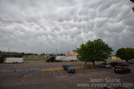
Mammatus outside our hotel in North Platte

Mammatus outside our hotel in North Platte


All checked in and settled in our rooms, we decided to head for some food at the nearby Perkins diner. We wanted to eat quickly as there were storms following behind the ones that we were chasing and they were due to pass overhead. As we left for the diner, we could see the shelf cloud of the storm passing towards us rapidly. I rushed down to the car to put my SJCAM on the dashboard and left it to record as we went on to eat. Approaching the diner, the gust that came from the storm kicked up a lot of dust, causing a small dust storm as we rushed the short distance to the diner.


Dinner complete, we returned to see some storms heading towards us again. Daniel Gregory had made his way here and suggested we meet him for some drinks in the bar. This bar is the one where storm chasers can sign the menu, so eyesonjason is now immortalised on a menu in Nebraska (well, until the pen fades anyway).


Finishing our drinks, the storm that had been firing away in the distance had become extremely close. Frequent cloud-to-ground lightning strikes, coupled with cloud-to-cloud lightning made it easy pickings to get photographs of lightning in this storm. So easy in fact that it was actually much harder to take a picture of the sky that was without some form of lightning! We also experienced our first shotgun thunder event, when a CG struck about quarter a mile to our south, with the thunder that followed sounding like a shotgun blast happening beside you. Incredible night - with plenty of footage captured to sort through and publish when back in the UK.


Frequent lightning on a severe warned storm in North Platte, Nebraska

Frequent lightning on a severe-warned storm in North Platte


When the intensity died down, I gave Hannah a video call to let her know I was safe, before falling asleep.  The SPC had upgraded the risk from a slight to an enhanced with a 5% chance of tornadoes for the next day, so sleep was definitely needed to be fresh for the day ahead.

Travel Day - May 26th

Posted on 29th May, 2018

Today doesn't really have much to talk about - as it was only ever going to be a travel day. We decided that the main risk for Sunday would be in north-east Colorado or the Nebraska panhandle. We had a leisurely start to the day in Elk City (Oklahoma), with a quick breakfast before hitting the road. Our target was initially to make it to Colby in Kansas.


Adam started the driving today and our plan was to have lunch in Liberal, Kansas, where we enjoyed a Subway. The ladies that served us were very interested in our language and culture - asking many questions and also getting us to speak in our British accents.


I took over the driving from here. Olly checked the models and thought we should have been a bit further east, so we re-routed to Burlington in Colorado. Olly outdid himself in finding our location for the night, the Western Motor Hotel. Let's just say it reminded me of the Bates motel from Psycho. It was a bit of a dive.


We walked up to the local restaurant - The Dish Bowl, which was fantastic. Great service, good beers and a brilliant meal - meatballs and spaghetti. I tried the Dead Guy ale (tall, of course), whilst the lads enjoyed watermelon margaritas. This made the waitress's order check rather peculiar - "So that's two margaritas and a tall Dead Guy". Not every day that you hear that. 


The alcohol helped a little on our way back to the hotel, it wasn't  great place to stay and, amongst the chasers we know, it had the nickname of the "Burlington Murder Hotel". Well, you can't have it all and you have to take the good places with the bad. Night all!

Written May 25th, published today, again due to slow internet connections


Our day started with a Super 8 breakfast. The other thing that I remembered other than the smell of the Super 8 last year was that this particular Super 8 didn't offer a lot in terms of breakfast. I managed a bowl of Raisin Bran and a glass of orange juice, but that was all that appealed. a lady called Susan from California heard our accents and came to ask us a few questions regarding her upcoming visit to the UK. Wuestions ranged from opinions of certain places to how much fuel cost in the UK. The latter surprised me when worked out. Our fuel currently costs between $2.65 to $3/US gallon. Working out at the rate it has been back at home over here, it's about $6.50 to $7 a US gallon, whih makes petrol twice as expensive.


The risk today had been upgraded to a slight, due to a triple point set up in western Oklahoma, so we head south from Hays to our target area of Woodward, Oklahoma. I remember Woodward well, as we stopped here two years back for lunch and remember seeing an old-style movie theatre off of the main road that runs through the town. I also remember it from our first chase as a trio, where we got stuck waiting for a couple of long trains on our mad rush towards Wichita. I was driving and we stopped in Greensburg for fuel before reaching Woodward.


Upon arrival, I called home to speak to my parents, as it was their 16th wedding anniversary and i had yet to message them. I think they were pleased to hear from me and the success that we have had so far. I remembered there was a small cafe near to where we had parked and by luck located it within seconds. Our meal at Pollyannas cafe was tasty, even if it did look a little rundown inside with the slow service due to only one person out front. We all enjoyed a BLT sandwich with various sides and a soft drink. See Nature's Fury commented on our location and suggested we head to Braums for dessert, but the time we reached Braums, they had moved on. Not to worry though, as we did get to meet Paul Knightley and talk about the risk for the day.


Supercell Initiation above Canadian, Texas

Supercell initiation, looking towards Canadian, Texas


It wasn't long before we needed to get back to the car, as the temperatures outside were in the 90s and you could feel your skin starting to sizzle when out in the sun. A joint decision to head south west towards where initiation was decided and we parked up in Fargo to watch a cell appear in front of us and grow rapidly. This was our cell and the chase begun.


Rapidly forming LP Supercell with mammatus

Growing LP supercell, remained stationary towards the Texan border


The cell showed on the satellite as just east of Canadian, but did not appear on the radar for a good 45 minutes to an hour after was saw it. This cell had a strong updraft and the conditions meant it had started to rotate. We continued south west towards Gage, before dropping south on the 46 towards Arnett. At Arnett, a small lay-by gave us the chance to take some photographs and admire the spectacular mammatus clouds forming above our heads. It was also producing some frequent cloud-to-ground lightning, so we had to exercise caution when we left the vehicle.


We travelled further south again towards the town of Roll, before heading west towards Durham. We sat near Durham for a fair while, watching the storm develop a nice meso. Radar showed the whole thing rotating from tilt one to tilt 4 and a strong couplet noted. See Nature's Fury passed us and parked up for a chat, although everyone was a little edgy due to the frequent CGs that rained down around us. For those worried about me at home, I sat safely in the car - lightning is one thing I really don't like chancing.


Admiring the new supercell, with See Nature's Fury to the bottom right

Admiring the new LP storm forming - See Nature's Fury also cameoing


Sadly the cell  had started to die off. The SPC had given the area a 2% tornado risk, should the storm move eastwards, but it stayed put until its death. Whilst dying off, a new cell formed rapidly in front of us and seemed to be feeding off of the dying storm. A wall cloud had descended on the new storm, rapidly becoming a low precipitation supercell.


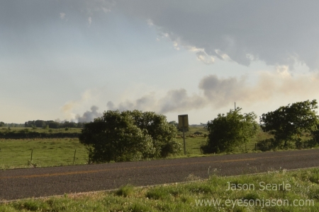
The lightning in the area did not mix well with the dry landscape and some of the nearby lightning strikes causing localised fires. Smoke plumes appeared in several areas of the landscape and the small fire engine that raced by to sort it out looked like it was going to have some difficulty controlling it!


Wildfire started by close lightning strike

Close cloud-to-ground lightning causes wildfire


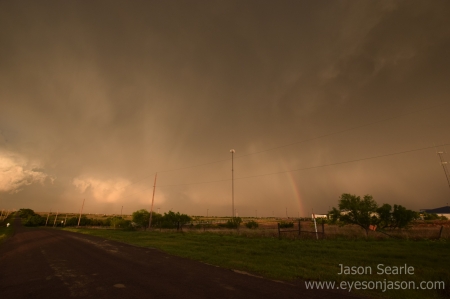
It was beginning to get late, so we had to decide where we were staying for the night. We didn't want to sack this one off just yet, but similarly we didn't want to be restricted when it comes to hotel choice and food options. I suggested we chase the storm south towards Erick, before heading back north west through Sayre. Enroute to Erick, the storm started to be lit up by the setting sun, giving perfect lighting conditions for some brilliant photo opportunities. Sunset, storm and rainbows - absolutely stunning.


Sunset lighting up the storm

Storms always look awesome in setting sunlight


We ended up booking the Super 8 in Elk City (one week after we stayed in Elk City last). Before wishing the storm farewell, we sat off the I40 near Sayre to enjoy the sunset-lit mammatus and structure, before dining in the Boomtown Grill in Elk City.


I do have some incredible shots from today, but want to be able to bring out the best in them before posting them - so stay tuned to the blog/facebook/instagram when I return in early June. 


Tomorrow looks to be a travelling day, heading north for a slight risk in NE Colorado to the Nebraska panhandle on Sunday. We thought the season may have been over due to the liklihood of a subtropical storm Alberto interfering with the weather here. We shall see...but a lee trough is providing some great chasing conditions through until Tuesday. 


Until then, stay safe and enjoy the storms (actually, this rings true for my UK readers too!)


Jason, Adam and Olly


The Explosive and Dusty Line - May 24th

Posted on 26th May, 2018

(Written on May 24th 2018 - delays in internet connection slowing blogging! Sorry!)


Happy Dodge Day for today (May 24th), as today marks two years since the cyclic supercell that gave us 17 tornadoes to marvel at passed over Dodge City, Kansas. It seems only fitting that today's slight risk shows storms developing over the western parts of Kansas. So, leaving around 8:30 am, we hit the road from Hot Springs, South Dakota, down through Nebraska and down into Kansas.


The journey was approximately 6 hours drive, stopping in the Nebraskan town of Ogallala to gas us and grab a bite to eat. I exchanged pleasantries with the gas store cashier, who asked where I was from and what I was doing in his neck of the woods. He wished us well in our hunt for storms and we were on our way. We pulled in briefly  for lunch at the McDonalds on "Big Mac Road", where there obviously was only one choice I had to pick. Yes, I've eaten a Big Mac on Big Mac Road.


Explosive convection in Colby, Kansas

Explosive inititation over Colby, Kansas


We arrived in Colby after what seemed like an age of driving. We had learned our lesson from the Pine Ridge chase and made sure we fuelled up as soon as we hit Colby. Just around the corner from the gas station, we found another McDonalds, where we sat and awaited initiation (with a milkshake in hand, of course!)  The initiation did not take long to get going and once started, it went up explosively. It sort of reminded me of the moderate risk day in Nowata, OK, towards the end of last year's chase, where the convection strength was visible to the naked eye, rocketing upwards and ballooning outwards rapidly.


Once it appeared on the radar, we set east to chase. Ideally we wanted to get out in front of it. A slight misdirection put us on a south road, so a bit of navigating was needed to get back on the east road and in front of the line. We pulled back east at a town called Gem, before holding our position just west of Hoxie. We saw the cells starting to line out, but the hail markers on the storms showed they were producing sizeable hail - up to 2 inches in size.


Waiting patiently for storms to develop

Awaiting storms to organise


The cells took a northeast track, but did so very slowly. More cells were forming at the start of the line, which ruined our hopes of a discrete supercell developing. That said, we saw frequent lightning and some nice structure developing.  We heard from Daniel Gregory that he would be heading our way and then down south to Oakley to observe the structure, but we didn't get the chance to meet at this point.


Feeling that our chase day was in vain, we decided to drive through the hail core, just to tick it off our list. Hail was reported to be only 1.5-2.0 inches in size, so felt that we could manage this easily. Heading west, the core punch (driving through the area of the storm where precipitation is strongest) entertained us at least.


Preparing to punch the weak core

Preparing to punch the weak hail core


Once we had been through the core (and contemplated coring it again), Olly suggested that we head south to Oakley and observe some of the structure.  Adam and I decided that this would be a great idea. On our way, we saw some frequent lighting from one of the cells to our west, so a group decision to pull over was made. Some of the photographs were amazing, capturing lightning on nearly every shot. The gust front also kicked up a lot of dust, causing a dust storm to occur. Our phones collectively buzzed and lit up, as emergency broadcast information warned us of this threat.


Structure and a dust storm

Watching a dust storm under storm structure


We continued to photograph this storm until the strong winds kicking dust our way hit. We managed to see a gustnado within this dust storm, but did not want to stick around too long as visibility was dropping rapidly. Daniel was up ahead and suggested we drop south at Grainfield in the hope to get out in front of the line that our storm cells had formed. A short drive down pass Grainfield to Gove City had Daniel turn around and head back to Colby. We decided to sack this off and head east to Hays, where we planned to have dinner and stay the night.


Throughout our drive, the lightning from the line of storms ramped up exponentially. What started with the occasional CG lead to a barrage of approximately a strike a second. We also thought a scraggly wall cloud formed in front of us, but this soon dissipated.


We figured that we were close to the leading edge of the storm, so we pushed on. I am so glad we did as the shelf structure that fronted this line of storms was awe-inspiring.  Some of the structure from this storm, coupled with the intense lightning barrage salvaged us a chase day.


Thankfully, there was a rest area ahead of us, so we pulled over and started taking a few images (amongst a good 30 other chasers that appeared out of nowhere). I also utilised the opportunity to "go live" on Facebook for the first time - sharing this experience in real time with my Facebook friends as we passed through WaKeeney. Thankfully there were opportunities to pull in front of this shelf and take plenty of photographs, many of which I will share when I am back from the chase this year.


Epic structure in front of the line

Epic structure in front of the line


Eventually, we arrived in Hays and checked into the Super 8 (The very same as the one I stayed in with Netweather last year...you know, the one that stunk of cannabis?). This year it smelt so much better and has to be one of the nicer hotels we have spent the night in this chase. Once checked in, with food on our mind, our regular trip to Applebees occurred whilst the storm passed overhead.


Our plan for tomorrow? A marginal risk in eastern Kansas. It might not be much, but it is at least a risk. We seem to be nailing this storm chasing thing - with a lot more success than I had expected. It's a shame this is going to be my last chase season (for a very long time, if not, ever...) as it would be interesting to see what would be capable if we had a decent season to chase!

The Pine Ridge Supercell - May 23rd

Posted on 25th May, 2018

(Written on May 23rd - Posted 25th (Internet access strong enough to blog has been patchy this year!)


Last night's hotel destination put us in brilliant position to chase a fair few targets, so it felt good to have a relatively relaxed start to the day. Our breakfast was filling and we had a brief conversation with some Kansans, who were interested in our accents and our storm chasing endeavours. Daniel and Dave spent the night in the Days Inn opposite. We reunited and decided to hang around in the central panhandle for a few hours to see what initiates (and where) to start the chase.


We used the time to visit the Scotts Bluff National Monument again, just this time in daylight hours (and to visit the top of the bluff). The weather was glorious and I managed to record our drive up to the top of the bluff. There were some impressive views across Nebraska and we could even seen storms popping up in Wyoming to our west.


Jason on top of Scotts Bluff National Monument
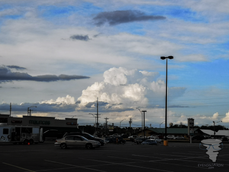
Scotts Bluff National Monument


We stayed a good hour and a half, wandering around the bluff and admiring the views. We bumped into a young lady and her daughter, mum and aunt whom gave us some more information about the area and said that the area is usually brown with drought, but a recent rainfall event about a month ago saw 7 inches of rain fall in a day (usually only receiving about 16 inches over an entire year), so the area was much greener than normal.
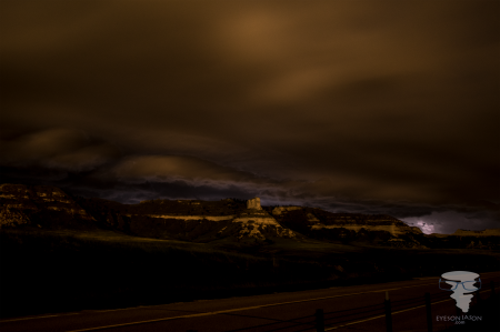
 

Upon leaving the bluff, we discussed with Daniel the options. He was keen to shoot up to South Dakota to see the risk near the Black Mountains, whereas we saw more potential in NE Colorado and into Nebraska. We parted ways and head south to Kimball, where our plan was to stick in this sort of region for a little longer and see what the mesoscale discussions (MDs) were saying and launching off when we got news. Our meal was a relatively standard Pizza Hut at Kimball.  Talking with See Nature's Fury, they were also in Kimball and holding fire in a similar way.


An MD was issued for eastern Wyoming and South Dakota. We could see the storm heading towards us and we made a bolt north. A bit of navigating gave us a north south road up via Scottsbluff and towards Mitchell, with view to wait in Agate for it to roll over us.


As our luck had it, the storm started forming a line and eventually started to die off. Typical!

We were already on the road to South Dakota at this point and I had noticed some initiation directly in front of us. This had started suddenly, and we watched as the convection grew high into the sky. We saw it form several pileous clouds as it pushed the cap, before it broke through with relative ease before developing explosively through it. This was our cell and, one that not many chasers (if any) were on.


The cell that started our main journey, with the Wyoming storms to the left of the picture

Our initial cell, that had explosive convection and dominated most of the chase


Thankfully we were on a good north-south road in order to chase it further north. It soon started to develop supercellular characteristics, with some lightning developing from it. There were also signs of rotation in this storm, both visible and radar-indicated. We were impressed!


We pushed on further north to Harrison, before taking an east road towards Crawford with the hopes of a north road to take us out in front of it. Our views on the road to Crawford were spectacular - we had canyons and trees, with an ominous shelf cloud rolling towards us in the background.


Shelf cloud rolling in on towards Crawford, NE

Shelf cloud roling in as we made our way to Crawford, Nebraska


We were concerned our north road curved to the west and would put us in the direct path of it. Thankfully, a few miles further east there was another north road at the town of Chadron. We got some more spectacular views of the structure a we carried on east. We then managed to go back and drive parallel to the line of storms that it had now become. There were areas of rotation indicated on the radar and we did see some small, messy wall clouds dropping from the storm. We were close to the South Dakota border at this point and we decided to head towards the town of Oelrichs before the core hit. The hail was only indicated to be 2 inches but we wanted to keep in front of the storm. As we did this, Reed Timmer blasted southwards passed us, of which we expected him to be chasing the tail-end charlie of the line, which had briefly crossed my mind. It seemed a bit far south to chase, so we kept on our line.


 Adam and Olly admiring the storm

Adam and Oliver admiring the storm


An east road at Oelrichs saw us another east road towards Oglala. We took this and pulled up a few miles east of Oelrichs, contacting Daniel Gregory, who had also decided to head towards our location. Whilst sitting just off the road, a new cell appeared on radar directly to our south. It appeared suddenly and was massive. This could be the cell that we wanted as it was discrete and heading in an east-northeast direction. We could get in front of this storm if we drove to Oglala and then pushed through to Pine Ridge. My concern was this road was purely a west-east road, but did curve north to let us get in front of it. It was going to be close, but felt that we could get out in front of the storm and power on east at Pine Ridge and power on in front of it.


At this point, the storm intensity grew exponentially. It was severe warned, but had no tornado warning, despite some areas of some strong rotation. No clear hook or tight rotation was noticed in our location, but my goal was to get the team to Pine Ridge and eastwards as soon as possible. It was quite intense getting everyone to understand why we needed to push on and not get out to take photographs, but once Olly spotted a funnel forming just in front of exit route, I think the team understood and we powered on East (albeit through a small residential area with awful speed control measures).


The Pine Ridge Supercell

The Pine Ridge supercell


Moving a few miles east, it was safe enough to get out and get taking shots of the structure that had formed behind us. It still hadn't gone tornado warned, but we did feel confident with the signs and characteristics it showing that a tornado was likely. We did spend some time watching and pushing east, but it never did drop.


Our next challenge was to find somewhere to stay and to refuel. We had about 100 miles on the range and although we drove to Allen for a gas station (where the core could scrape by us) the gas station was abandoned. This posed a problem. There were barely any hotels in this area of South Dakota and we had decided Hot Springs was our target for the night, which was about 100 miles away... We had one about 15 miles to our east in Martin, but this would have been a 30 mile detour from our target destination. The other was on the route in Pine Ridge, which we had been informed is pretty much a no-go area in the Indian Reserve that is there (there is a longstanding resentment towards caucasians due to the history and the way their tribe has been treated over the years). We decided to keep to the main road gas station and then power on to the Hot Springs American Best Value Inn for the night.


Hot Springs was nice - although our late return meant most food venues were closed, so a gas station dinner was on the cards. Thankfully I had half of my pizza from lunch left over, which I scoffed quickly before falling quickly to sleep.


We had a relatively leisurely start today, although I had been woken up by the neighbouring room at 3 in the morning. I'm not sure what was going on - it sounded like a cross between a massive argument and rampant sex. Either way, it was disturbing and struggled to sleep after that. I was in a room far away from the others so met up at breakfast. Interestingly, See Nature's Fury stayed in the same hotel and it was once again good to catch up.


It was my turn to put some miles in and around 9:30 we set off north and up through the I25 into Colorado. We were on the eastern edge of the Rocky Mountains and the drive was the most spectacular journey I have ever undertaken. Canyon-like terrain with snow-topped mountains in the background. It was stunning! I've often become tearful with awe when it comes to weather, but it's the first time a landscape scene has overwhelmed me.


Rocky Mountains in the background, driving along the I25

Nice view of the Rocky Mountains on our drive north along the I25


Pulling in the miles, we stopped in Puerto for some fuel. For a massive city, we really struggled to find a gas station. After a real convoluted trip around the suburbs, we eventually found one, topped up and then continued our journey.


Daniel and Dave had already ended up about 60-80 miles to our north by this point, so (for today at least), it was just the three of us. They aimed to meet us in Castle Pines, which is south of Denver, for lunch. They were long gone by the time we were able to reach them. We stopped for lunch at Pino's Italian. Our server, quite possibly Pino himself - we never did ask, was very attentive and friendly. Great sandwich, a Dr Pepper and a comfort break saw us back on the road, with Olly taking the wheel.


The journey took us north up through Denver. Driving on the main route through Denver was a bit fraught, where high speeds, lack of people providing braking distance and last minute lane changes made this part of the journey higher octane than chasing a storm! Once through the centre, we head north west towards Sterling for a refuel and then onwards to Sidney in Nebraska, to re-evaluate models and see what was kicking off around us.


At Sidney, we decided that given the models and the direction of the storms that were kicking off, that Alliance may be the next logical stop. It would appear that Dave and Daniel also had the same idea - as they ended up missing some of the storms that kicked off in the south of South Dakota. Due to lack of data coverage (thanks Nebraska...) we missed the mesoscale discussion issued. Reading through, we decided that we would need to head back west towards Scottsbluff and potentially then onwards into Wyoming. Letting Daniel and Dave know, they also confirmed they had decided to return to Scottsbluff (which was our earliest target suggestion today...) and we would meet up and discuss what to do next. 


We had arranged to meet in the Walmart and whilst waiting, a storm cell had shown explosive initiation to our north-east in...you guessed it, Alliance.  What a troll Mother Nature can be. Given our position, the speed and the road layout of Nebraska, we wouldn't have been able to reach the storm, as it powered off into the north. Our only option was to sit as the storms from Denver rolled over to our position and hope for some lightning. 


The troll supercell, initiating where our target had been

What a troll... we were heading for Alliance but didn't stick with it!


I gave a shout to head towards the Scotts Bluff National Park, where some dramatic foreground of the bluff would make for some amazing photo opportunities. We parked up on a layby near the entrance and awaited the storms to roll to us. We were there for some time as the light started to fade - the storms were a good 40 miles away at the start, so we had a lot of time to kill. We were there for so long in fact that the local sheriff came to ask us what we were up to. He was fine with us being there, although warned us of the dangers that lurked within the grass (mainly the odd rattler, or the coyotes in the area...). He seemed a bit more distracted by a corvette that sped pass us whilst chatting to us...


Eventually the storm rolled in over the bluff...and the following photographs speak for themselves. They lacked the lightning we had hoped, but the long exposure on their structure was well worth waiting for.


Long exposure of a shelf cloud rolling in over the Scotts Bluff National Monument

Storms rolling in over the Scotts Bluff National Monument


With a strong gust front to finish off the photography session, we left towards Applebees for our dinner, before retiring to our hotel rooms at the Super 8 in Scottsbluff. Despite seeing little storm action, we'd still consider the positive photography session a success. Our next chase area for tomorrow is yet to be decided, but with risks all around, we are perfectly positioned to at least get a storm. As always, thanks for reading!